
Introduction
Inspired by the scholarly article Urban Computing by Yu Zheng, Licia Capra, Ouri Wolfson, and Hai Yang.
Urbanization’s rapid progress has led to many big cities, which have modernized many people’s lives but also engendered big challenges, such as air pollution, increased energy consumption, and traffic congestion.
Nowadays, sensing technologies and large-scale computing infrastructures have produced a variety of big data in urban spaces (e.g., human mobility, air quality, traffic patterns, and geographical data). The big data implies rich knowledge about a city and can help tackle these challenges when used correctly.
For instance we can detect the underlying problems in a city’s road network through analyzing the city-wide human mobility data. This discovery can help better formulate city planning for the future.
Another example is to exploit the root cause of urban air pollution by studying the correlation between air quality and other data sources, such as traffic flow and points of interest.
We are able to tackle the big challenges in big cities by using big data.
We mainly discuss the aforementioned problems from the perspective of computer sciences.
Framework of Urban Computing
Definition
Urban Computing is a process of acquisition, integration, and analysis of big and heterogeneous data generated by diverse sources in urban spaces,such as sensors,devices, vehicles,buildings, and humans, to tackle the major issues that cities face.
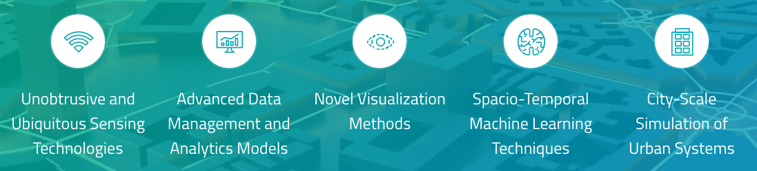
Urban Computing connects unobtrusive and ubiquitous sensing technologies, advanced data management and analytic models, and novel visualization methods to create win-win solutions that improve urban environment, human life quality, and city operation systems.
Urban Computing also helps us understand urban phenomena and even predict the future of cities.
General Framework
The general framework of urban computing is composed of four layers:
-
Urban sensing We constantly probe people’s mobility(e.g, routing behaviour in a city’s road network) using GPS sensors or their mobile phone signals. We also continually collect the social media people have posted on the internet.
-
Urban data management We organize the human mobility and social media data by some indexing structure incorporating spatio-temporal information and texts for supporting efficient data analytics
-
Data analytics We detect anomalies by identifying the locations where people’s mobility significantly differs from its origin patterns.
-
Service provision The locations and descriptions of the anomalies are sent to drivers nearby so that they can choose a bypass as well as delivered to transportation authorities for dispersing traffic and diagnosing the anomaly.
The system continues the loop for an instant and unobtrusive detection of urban anomalies, helping improve people’s driving experiences and reduce traffic congestion.
Key Challenges
Urban Sensing and Data Acquisition
- Energy consumption and Privacy
- Loose-controlled and nonuniform distributed sensors
- Unstructured, implicit and noise data
Computing with Heterogeneous Data
- Learn mutually reinforced knowledge from heterogeneous data
- Both efficient and effective learning ability
- Visualization
Hybrid systems blending the physical and virtual worlds
Urban Data
- Geographical Data
- Traffic Data
- Mobile Phone Signals
- Commuting Data
- Environmental Monitoring Data
- Social Network Data
- Economy
- Energy Consumption
- Health Data (e.g Impact of environmental change on people’s health)
Applications In Urban Computing
Urban Computing for Urban Planning
- Gleaning Underlying Problems in Transportation Networks
- Discover Functional Regions
- Detecting a City’s Boundary
Urban Computing for Transportation Systems
- Improving Driving experiences
- Improving Taxi Services
- Improving Public Transportation Systems
Urban Computing for the Environment
- Air Quality
- Noise Pollution
Urban Computing for Urban Energy Consumption
- Gas Consumption
- Electricity Consumption
Urban Computing for Social Applications
- Estimate user similarity
- Finding Local experts in a region
- Location Recommendations
Urban Computing for Economy
Urban Computing for Public Safety and Security
- Detecting Traffic Anomalies
- Disaster Detection and Evacuation
Typical Technology
Urban Sensing and Data Acquisition.
Passive Crowd Sensing
-
Sensing City Dynamics with GPS-Equipped Vehicles
-
Data Acquisition through Ticketing Systems of Public Transportation
-
Data Acquisition through Wireless Communication Systems
-
Data Acquisition through Social Networking Services
Passive Participatory Sensing
-
Human Crowdsensing
-
Human Crowdsourcing
Urban Data Management Techniques
Stream and Trajectory Data Management
-
Data reduction techniques for trajectories
-
Noise filtering techniques for trajectories
-
Techniques for querying and indexing trajectories
-
Techniques dealing with uncertainty of trajectories
-
Trajectory Pattern Mining
Graph Data Management
Hybrid Indexing Structures
Knowledge fusion across Heterogeneous Data Sources
Techniques Dealing with Data Sparsity
- Collaborative Filtering
- Matrix Factorization
- Tensor Decomposition
- Supervised Learning and Transfer Learning
Visualizing Big Urban Data
Other Techniques
- Optimization Techniques
- Information Security
Future Directions
- Balanced Crowdsensing
- Skewed data distribution
- Managing and indexing multi-mode data sources
- Knowledge Fusion
- Exploratory and interactive visualization for multiple data sources
- Algorithm Integration
- Intervention-based analysis and prediction